Recognition
![]()
In 2012, NASA and the U.S. Geological Survey selected six out of 172 submissions from the American public and created customized Landsat chronicles of changing local landscapes.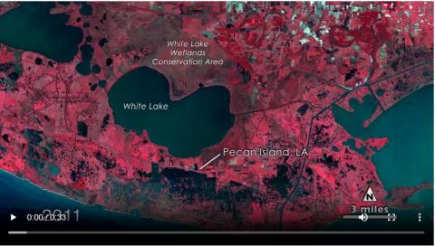
2012 NASA / USGS “My American Landscape Award "Pecan Island Study
American Landscapes – Vermilion Parish, La.
Submitted by Brent Yantis and Whitney Broussard
The lower Mississippi River has greatly impacted the landforms of Southern Louisiana. Despite modern engineering efforts and the presence of the Chénier Plain salt marshes, the coastline is being eroded by the open ocean. To address this issue, the LouisianaView program, under the guidance of the Regional Application Center, created an educational research application that utilizes Landsat Imagery to showcase the changing coastline of the Southwestern Coastal Chénier Plains. This application was recognized as a finalist at the July 27, 2012, Smithsonian ceremony honoring "My American Landscape" winners, as identified by NASA.
See article with videos and photos