More about Mr. Brent Yantis
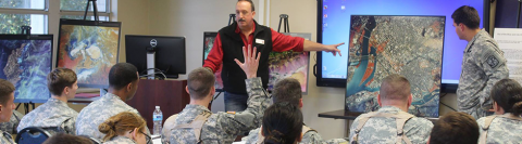
Meet R. Brent Yantis, a highly skilled Landscape Architect with a Master's degree in Remote Sensing and a minor in Art. With over 30 years of experience in geospatial land cover/environmental change monitoring and emergency response, Yantis is currently serving as the Director of the UL Lafayette Regional Application Center. He has been teaching at the university level for the past 21 years and has also worked on a 22-year GeoSpatial consulting contract with the Louisiana Army National Guard.
Prior to this, Yantis spent nine years as the Louisiana GeoSpatial Coordinator Specialist with the USDA Natural Resources Conservation Service and started his career in private industry, working for 5 years with an International Oil and Gas environmental support company.
Throughout his career, Yantis has mentored numerous undergraduate and graduate students, placing many in geospatial jobs and advanced geospatial studies across the United States. He currently serves on the Louisiana RS/GIS Conference Board, and the National AmericaView board, and is a member of the American Society for Photogrammetry and Remote Sensing.
Yantis is also a Program Manager for the UNISPACE International Charter for Space and Major Disasters, involved in emergency geospatial data acquisition during natural disasters such as Hurricane Katrina, the Louisiana/Texas floods of 2016, Hurricane Harvey, and many more! He is passionate about expanding the realm of Geosciences across multiple states and building a template for each state and institution to implement in the future, while also broadening the impact of STEAM education in the Gulf South.