Earth as Art Traveling Exhibit
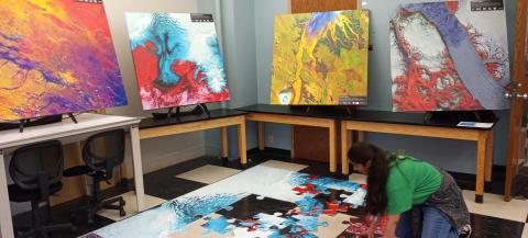
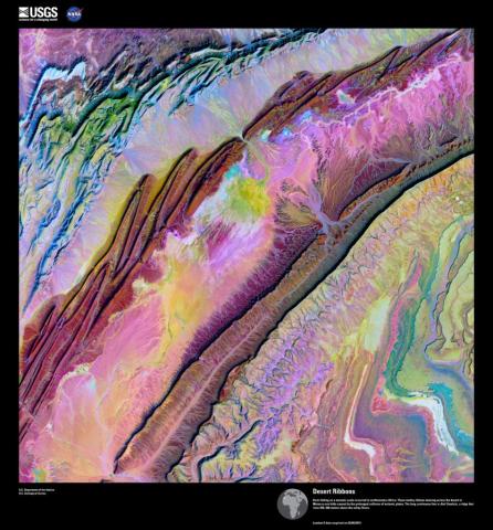
The Earth as Art exhibit features remarkable images of the surface of the Earth that have been captured by remote sensing devices aboard LANDSAT satellites operated by the U.S. Geological Survey and NASA. It is presented by Louisiana Remote Sensing and GIS Institute in coordination with the UL Lafayette Regional Application Center and LouisianaView.
Bridging the Gap Between Art and Science
The Gallery Exhibit is a program that provides opportunities for students to produce artwork from satellite and other remotely sensed images. The art describes features, events, or impacts on, or near, the surface of the earth.
The Earth as Art exhibit is the Intersection of ……… Science, Technology, Engineering, Art and Mathematics (STEAM)
The artwork is critiqued and selected to serve as part of an educational and informative traveling exhibit, facilitating conversation and understanding of our world through a unique and memorable perspective. ESRI Story Maps are a tool utilized by students to create these unique educational outreach perspectives.
Read more about our life-size puzzles
A message from an exhibit host…
“The traveling Earth as Art gallery exhibit elevated our Earth Day event at New Orleans City Park artistically and scientifically.” — Liz Lowe, New Orleans City Park
Interested in hosting an Earth as Art Exhibit?
Email us for more information.
View Full Earth As Art Gallery
Louisiana Remote Sensing & Geospatial Information Systems Institute (LARSGIS) - https://larsgis.org/
