or reload the browser
or reload the browser
or reload the browser
or reload the browser
or reload the browser
or reload the browser
or reload the browser
or reload the browser
or reload the browser
![]()
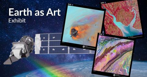
(Lafayette, LA) The University of Louisiana at Lafayette Regional Application Center (RAC), specializing in satellite imagery and remote sensing technology, has been invited by the United States Geological Survey (USGS) and the National Aeronautics and Space Administration (NASA) to the Landsat 9 satellite launch at Vandenberg Air Space Base in California during the last week of September, to display the university’s “Earth as Art” satellite images traveling gallery exhibit, sponsored in part by the National AmericaView program “Empowering Earth Observation Education”.
The Landsat satellites continuously photograph the earth using remote sensing devices measuring land cover, water, and ecosystems. The images are shared with the military, governmental agencies, research centers and the public.
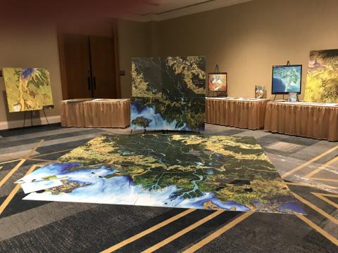
The students produce the images for the “Earth as Art” traveling collection celebrating the aesthetic beauty in the patterns, shapes, colors, and textures of the land, oceans, ice, and atmosphere. Some examples of their work can be viewed at rac.louisiana.edu. and louisianaview.org. The exhibit will be displayed at all events leading up to the Landsat 9 launch. The team created gigantic floor puzzles of the city and landscape surrounding the launch site on behalf of the USGS, for the children of the Lompoc/Santa Barbara area and plan to gift it to the city and school system. The students are eager to share their work in support of the university’s Science, Technology, Engineering, Art, and Mathematics (STEAM) initiative and ignite the public’s curiosity about remotely sensed imagery.
In addition to using the images for art, Brent Yantis, RAC director and Chairman of the Board for the National AmericaView program explains his team can “receive, manipulate, and disseminate satellite and other remotely sensed or geospatial data effectively and inexpensively in near real-time for any application development.”
The RAC works directly on projects with the United States Geological Survey, the Louisiana National Guard, NOAAs Weather Ready Nation program, the Louisiana Remote Sensing and GIS Institute, AmericaView and local governments and emergency response agencies.
In addition, Yantis is a program manager for the International Charter, an agreement between all nations to share satellite data in the event of an emergency. Yantis said, “Most people are not aware that our students are working on these projects and showcasing their work internationally.”
Courtney A. Poirier, PhD student in the school of Geosciences said “Completing classwork in the GIS and Remote Sensing curriculum, along with working as part of the RAC has brought me a newfound love and appreciation for Art. This outreach program coordinated through the RAC focuses on the collaboration between a wide range of STEM related disciplines, while adding in the Visual Art component. We have been able to showcase firsthand, real-world problems and illustrate the science behind each project theme using imagery as the component of Art. Not only does it create a stunning picture of the Earth’s landscape, but it is able to highlight features of the landscape that the public-at-large has never really seen before.”
The center gives the opportunity for students to explore unmanned aerial vehicle coordination and light detection and ranging (lidar) remote sensing platforms that enable rapid 3D structural data collection. These technologies help research watershed delineations, land cover changes, military decisions and more.
The future is bright for these GIS students as more data, GIS, and other variables are collected; the ability to manipulate and interpret these models is invaluable. The technology needs span emergency response, coastal restoration, transportation, agriculture, disaster mitigation, forestry, human health, etc.
The Landsat satellite system is extremely valuable to so many industries as the longest continuous global record of the Earth's surface from space, going on 50 years. Landsat 9 will collect images of the Earth every 16 days in an 8-day offset with Landsat 8 collecting as many as 1,500 new scenes a day for the US Geological Survey Landsat archive.
UL Lafayette students can become geographic information science (GIS) certified through the RAC and the UL Lafayette Board of Regents approved Certification program. The center also offers GIS continuing education classes and workshops, including coordinated training for Geospatial First Responders for hurricanes and other disasters, now entering its 22nd year.
“Building on its work with AmericaView, USGS and NASA on the Landsat satellite program and Earth as Art exhibitions the RAC is now embarking on a new frontier through a National Science Foundation grant to empower earth observation education for Local High School Students and those continuing enrollment at the university in STEM related education and research over the next three years. This is an exciting new endeavor, as the RAC, working with university students works to support the next 50 years of Landsat satellite technology, education and outreach through the Earth as Art gallery images of this planet we call home.
If you are interested in learning more about the RAC center at UL Lafayette or hosting the “Earth as Art” exhibit, please contact Brent Yantis at (337) 482-0670 or email yantis@louisiana.edu.
###
Press Contact
Andrea Frey
Regional Application Center
337-482-0627
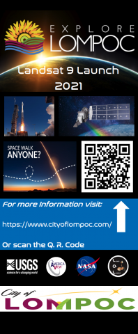
Images by Explore Lompoc.com (https://explorelompoc.com/event/earth-as-art-exhibit/) and the RAC
