or reload the browser
or reload the browser
or reload the browser
or reload the browser
or reload the browser
or reload the browser
or reload the browser
or reload the browser
or reload the browser
The Ray P. Authement College of Sciences is pleased to host The Sciences Interdisciplinary Monthly Meeting (SIMM). This seminar series is designed to foster interaction among faculty and students within the academic units of the college. Interested parties from outside the college are encouraged to participate as well.
An Inside Look into the World of Imagery
R. Brent Yantis, Director
NASA/UL Lafayette Regional Application Center
3:30 - 5:00
Tuesday, 22 February 2022
Abstract
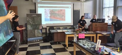
The University of Louisiana at Lafayette Regional Application Center (RAC), specializing in satellite imagery and remote sensing technology, receives, manipulates, and disseminates satellite and other remotely sensed or geospatial data effectively and inexpensively in near real-time for any application development. One such technology is the NASA/USGS Landsat program of satellites. The Landsat satellites continuously photograph the earth using remote sensing (RS) devices measuring land cover, water, and ecosystems. The images are shared with the military, governmental agencies, research centers, and the public.
The RAC works directly on projects in Emergency/Disaster Response, Workforce Development, Agency Contracts, Applied Research, along with Education and Outreach. Many of these endeavors involve working with the United States Geological Survey, the Louisiana National Guard, NOAA Weather Ready Nation program, AmericaView, and local governments, along with emergency response agencies, local and across the Americas. The Landsat satellite system is extremely valuable to so many industries as the longest continuous global record of the Earth's surface from space, going on 50 years. Landsat 9, launched September 2021, now collects images of the Earth every 16 days in an 8-day offset, with Landsat 8 collecting as many as 1,500 new scenes a day for the US Geological Survey Landsat archive. These images work alongside collections from the European Space Agency (ESA) Sentinel Satellite program.
UL Lafayette students can become geographic information science (GIS) certified through the RAC/School of GeoSciences/Geography and the UL Lafayette Board of Regents approved Certification program starting Fall of 22. The future is bright for these GIS/RS students as more data, Imagery, and other variables are collected; the ability to manipulate and interpret these models is invaluable. The technology needs span emergency response, coastal restoration, transportation, agriculture, disaster mitigation, forestry, human health, and the list goes on.
The center also offers GIS/RS continuing education classes and workshops, including coordinated training for Geospatial First Responders for hurricanes and other disasters, now entering its 23rd year. The RAC was invited by the United States Geological Survey (USGS) and the National Aeronautics and Space Administration (NASA) to the Landsat 9 satellite launch at Vandenberg Airspace Base in California during the week of September 16, 2021, to display the university’s “Earth as Art” satellite images traveling gallery exhibit, floor puzzles, and outreach materials. The RAC worked as part of the education and outreach component of the launch. This launch marked the beginning of the 50th-year celebration of the Landsat satellite program, continuing through 2022.
Building on its work with USGS and NASA on the Landsat satellite program and Earth as Art exhibitions, the RAC is now embarking on a new frontier through a National Science Foundation grant to empower earth observation education for Local High School Students and those continuing enrollment at the university in STEM related education and research over the next three years. This is an exciting new endeavor, as the RAC, working with university students, works to support the next 50 years of Landsat satellite technology, education, and outreach through the Earth as Art gallery images of this planet we call home.
About the speaker
Brent Yantis is the Director of the NASA/UL Lafayette Regional Application Center at the University of Louisiana at Lafayette. Having a degree in Agriculture and a Master’s in Landscape Architecture: Landscape Ecology/GIS and Remote Sensing, he is the current Board Chair of the National AmericaView program; Director of LouisianaView; State GeoSpatial Contractor to the Louisiana Army National Guard and USGS; and is a member, past President, of the Mid-South ASPRS and member of the Louisiana and Caribbean chapters of URISA working in emergency response since 2001. He hosts training for Natural Disaster and Emergency Response held annually for 23 years. His affiliation with the International Charter for Disaster Response as a Project Manager since 2006 has led to working with Hurricanes Ida, Laura, Delta, Rita, Katrina, Ike, Gustav, Andrew, Florence, Michael, Dorian (to name a few) and Oil Spill response to the DeepWater Horizon, along with flood mapping in Nepal.
He worked as geospatial data coordinator, Project Manager, for the International Charter activations for 2016 in both Louisiana and Texas during the March, May and August Floods, Hurricane Harvey in 2017 and satellite imagery coordinator, working with 17 countries for Hurricanes Florence and Michael in 2018 and in 2019, Hurricane Dorian over the Bahamas. Brent teaches GIS and Remote Sensing classes as part of a certification program at the University of Louisiana at Lafayette and has developed an “Earth As Art” Traveling Art Exhibition for remote sensing satellite imagery working with the USGS and NASA programs. This Art gallery exhibit was on display at the USGS National Headquarters – Reston, Va. in March 2019, USGS EROS – Sioux Falls, SD in 2017 and over 20 state exhibitions since 2013.
Brent, as part of a UL Lafayette team, was awarded as a finalist in the NASA “My American Landscape” national competition for the 40th Anniversary Celebration of Landsat 2012, along with the Outstanding Service Award for Remote Sensing Outreach Activities in Washington, D.C. in 2013 by AmericaView. He was awarded the 2013 Distinguished Service Award for the Advancement of Spatial Analysis in Louisiana by his peers in GIS and Remote Sensing and has received awards in 2014, 2015, and 2016 from the AmericaView program for the advancement of Remote Sensing. In the Fall of 2021, he was commissioned by USGS and NASA to bring the traveling Earth as Art Gallery Exhibit and assist in the public and student education outreach, utilizing materials he helped NASA and USGS develop for the promotion of the Landsat Satellite remote sensing program. These activities were conducted as part of the launch of the Landsat 9 satellite system. Currently, Brent is working as part of the national outreach program to highlight the 50th Anniversary of the Landsat program with NASA and USGS and overseeing the implementation of his NSF GeoPaths grant: GEOSERVICE – Geoscience Students Excelling in Real, Vital Investigations with Community Engagement (GEO SERVICE) working with UL Lafayette students, faculty, and the Lafayette Parish School System.
