or reload the browser
or reload the browser
or reload the browser
or reload the browser
or reload the browser
or reload the browser
or reload the browser
or reload the browser
or reload the browser
As part of the FlyHigh4Geo program, AmericaView and partners organized and conducted a STEM (Science, Technology, Engineering, and Mathematics) event at the ChiChil'tah Jones Ranch Community School (CJRS) on the Navajo Nation. CJRS is a U.S. Department of the Interior Bureau of Indian Education (BIE) operated school which provides primary education for students in the K-8th grades.
The FlyHigh4Geo program supported students in expanding their understanding of geography and developed important and valuable relationships between CJRS, AmericaView, NASA, and USGS for future educational opportunities.
Working with the teachers and administrators of CJRS, AmericaView initiated a school-wide event featuring a series of inspiring geography related educational activities through the National Geographic Society FlyHigh4Geo program.
At CJRS, AmericaView was able to produce interactive exhibits, including a large floor puzzle, which allowed students to explore the physical geography of their surroundings via Landsat satellite imagery. The puzzle, with Navajo language annotation, provided a cultural connection to important locations throughout the Navajo Nation. By including Navajo language annotations on the puzzle, students are able to learn concepts that relate to both the incredible geography of the Navajo Nation as well as the rich culture of its people.
 The floor puzzle gave students at CJRS the opportunity to associate their personal perspective of their surroundings from a ground-based view–in contrast to a view of their surroundings from a "satellite" (or birds-eye) view.
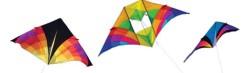
Partnering with the NASA and Wayne RESA AEROKATS program, AmericaView members from LouisianaView guided students in using airborne platforms to collect data and gain an understanding of remotely collected data as well as the physical processes of kite flying and the local landscape.
The FlyHigh4Geo program was meant to help support a different and unique view of the landscape, joining culture with geography as an immersive learning experience. View Earth from above, like an eagle or hawk might do, provides a perspective of the land that is impossible at the ground level. AmericaView incorporated several activities into the FlyHigh4Geo program including floor puzzles, collage activities, image interpretation, and stream tables to help foster a cultural tie to geographic concepts across the desert southwest landscape.
Full article: https://storymaps.arcgis.com/stories/39528fbe7ddc436bb4023f21870b1370
