or reload the browser
or reload the browser
or reload the browser
or reload the browser
or reload the browser
or reload the browser
or reload the browser
or reload the browser
or reload the browser
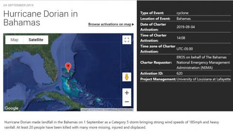
Hurricane Dorian made landfall in the Bahamas on 1 September as a Category 5 storm bringing maximum sustained winds of 185 mph, making it the strongest hurricane on record to affect the Bahamas. Multiple deaths and injuries resulted, as well as unimaginable damage to the environment.
The archipelago islands were battered by the storm for 2 days which decimated whole areas, leaving houses without roofs, scattered debris, and flooding as up to 35 inches of rain fell. Dorian also dropped an estimated 3.0ft. (0.91m) of rain over the Bahamas.
•Damage was estimated at more than $7 billion.
•Across the Bahamas, the storm left at least 70,000 people homeless. An estimated 13,000 homes, constituting 45% of the homes on the Abacosand Grand Bahama, suffered severe damage or were completely destroyed. UN officials reported 60,000 people required food aid and clean water.
•Look at just one aspect of the disaster response to underscore collaboration between the International Charter Space and Major Disasters Consortium and the AmericaView Consortium.
•https://disasterscharter.org/web/guest/activations/-/article/storm-hurri...
Brent is both the AmericaView PI for LouisianaView and the Board Chair. He and Teresa Howard of TexasView are often requested to be the Project Managers, given the number of disaster responses in the Gulf of Mexico.
Support National Needs
The Charter is a worldwide collaboration, through which satellite data are made available for the benefit of disaster management. By combining Earth observation assets from different space agencies, the Charter allows resources and expertise to be coordinated for rapid response to major disaster situations; thereby helping civil protection authorities and the international humanitarian community. This unique initiative is able to mobilize agencies around the world and benefit from their know-how and their satellites through a single access point that operates 24 hours a day, 7 days a week, and at no cost to the user.
In addition to the space agencies that form the Charter, national, and regional disaster monitoring organizations also support the Charter's efforts as co-operating bodies. Members and co-operating bodies join an international initiative to provide support to those in need following major disasters and benefit from the wide distribution of data that the Charter offers.
Disaster Relief Organizations
Following a successful activation of the Charter, end-users -typically disaster relief organizations -may receive satellite data of affected areas within a matter of hours or days; depending on the type of disaster and available satellite resources. Since 2007, the Charter has been activated 40 times per year on average.
Charter in Numbers
631 Activations
126 Countries
17 Charter Members
61 Contributing Satellites
AmericaView is a nationwide partnership of remote sensing scientists who support the use of Landsat and other public domain remotely sensed data through applied remote sensing research, K-12 and higher STEM education, workforce development, and technology transfer. Funded primarily by a grant from the U.S. Geological Survey, the AmericaViewconsortium is comprised of university-led, state-based consortia working together to sustain a network of state and local remote sensing scientists, educators, analysts, and technicians. Typically, those IC program managers, who are AV StateView PIs report on their work but during Dorian response, Brent decided to request some volunteer support from other StateViews.
•River Parishes Community College
•Specialist at the RAC Center in Lafayette
•Staff at the University of Arkansas
Remote sensing datasets
•Landsat
•Sentinel
•Radarsat
•Digital Globe’s WorldView and GeoEye
•TerrasarX •Civil Air Patrol imagery
Results delivered to •NEMA •Pacific Disaster Center
Article: chrome - https://www.fgdc.gov/ngac/meetings/dec-2019/remote-sensing-collaboration...
